Welcome to Frank Brusca's
Facebook   Twitter
Random Page
Dice
   
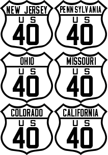
US 40 Shield
Route40.net
The best source of historic and contemporary information for America's finest transcontinental highway.
If you see a page you like, bookmark it with the social media links below.

Bicycle

Information for Bicyclists

When I was a teenager, I dreamt about riding my ten-speed across Route 40. I was a late bloomer when it came to getting my driver's license and used to ride my bike everywhere. In the summer, I would ride my bike along Maryland SR 144 (old Route 40) between Catonsville and Frederick.

Alas, I am middle aged and not in shape to execute this dream. (With enough training and prep I suppose I could make this happen!)

I thought I was the only one with such an interest but as my e-mail in-box can testify, I get at least one inquiry a month from someone wanting to do the same thing. If this sort of thing interests you, here are a few notes and observations.

Has It Ever Been Done?

Probably, but I have yet to find any record. In all likelihood, there have probably been a few long distance riders who have pedaled most of the highway's length. Buy I'll wager that to date no one has done a coast-to-coast trek on the highway.

Recommendations

  • Plan to travel from west to east. The westerly winds will make an east to west journey miserable.

  • Beat the heat. Plan to depart the Bay Area in the late spring, perhaps the last week of May. By that time of year the Sierra Nevadas and Rockies will be clear of snow and the temperatures in the desert regions will be tolerable.
  • Don't do it solo. Route 40 remains a busy highway and a bicycle is no match for an 18-wheeler cruising along at 100 MPH in Nevada. If you should run into any misfortune, having a buddy will be of great benefit.

  • Understand the limitations. You won't be able to do a 100% pure ride across Route 40. There are a number of places where toll bridges and modern highways will necessitate an interruption of your cycling on the Route 40 alignment and add lengthy detours.

  • Be prepared to stay at motels. There are many places along the route where there are no campgrounds.

  • Carry a cell phone. They're small, lightweight and they can be a real life saver. I'd get one of those solar chargers to make sure the battery is always topped off.

  • Use a GPS. Some of the detours here use some obscure back roads. This itinerary includes GPX files to guide you.
  • Check with the local authorities. In some instances, you may need to secure permits to ride a bicycle on Interstate Highways.

  • Plan Ahead. Use online services like Google Maps to scout out the availability of bike shops, motels, restaurants and grocery stores. Many sections of the highway have extensive sections (50 miles or more) where there are no services available. On those stretches, you will need to carry extra water and food.

Recommended Itinerary

Below is a recommended itinerary for a possible 33-day coast-to-coast bike trip. The itinerary is based on a daily average schedule of about 100 miles. I've done my best to provide routings that follow a Route 40 alignment (or one that is practically possible).

Important Notice

Please note that if you elect to follow this itinerary, you do so at your own risk. Failure to exercise good judgment can result in traffic violation citations, injury and even death. I can assume no responsibility for any errors in this information, nor can I be held responsible for anything that may occur while traveling along this route. If you are unsure about the legality of pedestrian travel along any of the roads described here, please consult with state and local law enforcement agencies.

Itinerary

Day 01
San Francisco to Davis
98.9 miles
Day 02
Davis to Rainbow Lodge
105.8 miles
Day 03
Rainbow Lodge to Fernley
92.0 miles
  Rainbow Lodge to Fernley with alternate routing between Truckee and Reno
91.9 miles
Day 04
Fernley to Mill City
112.4 miles
Day 05
Mill City to Battle Mountain
91.5 miles
Day 06
Battle Mountain to Elko
88.6 miles
  Battle Mountain to Elko with alternate routing via I-80 (not recommended)
71.7 miles
Day 07
Elko to West Wendover
132.8 miles
  Elko to West Wendover with alternate routing via I-80 (not recommended)
117.0 miles
Day 08
Wendover to Grantsville
97.8 miles
Day 09
Grantsville to Heber City
89.5 miles
Day 10
Heber City to Roosevelt
100.9 miles
Day 11
Roosevelt to Dinosaur
63.6 miles
Day 12
Dinosaur to Craig
89.0 miles
Day 13
Craig to Kremmling
94.8 miles
Day 14
Kremmling to Idaho Springs
82.0 miles
Day 15
Idaho Springs to Limon
126.2 miles
Day 16
Limon to Cheyenne Wells
86.7 miles
Day 17
Cheyenne Wells to Grainfield
106.7 miles
Day 18
Grainfield to Wilson
114.6 miles
Day 19
Wilson to Junction City
100.2 miles
Day 20
Junction City to Lawrence
100.9 miles
Day 21
Lawrence to Concordia
108.6 miles
Day 22
Concordia to Kingdom City
102.7 miles
Day 23
Kingdom City to Chain of Rocks Bridge
111.0 miles
  Alternate Route through Saint Louis - Wentzville to Troy (not recommended)
68.6 miles
Day 24
Chain of Rocks Bridge to Effingham
99.9 miles
Day 25
Effingham to Brazil
83.2 miles
Day 26
Brazil to Cambridge City
109.0 miles
Day 27
Cambridge City to Lafayette
98.7 miles
Day 28
Lafayette to Cambridge
100.3 miles
Day 29
Cambridge to Washington
87.3 miles
Day 30
Washington to Cumberland
99.6 miles
Day 31
Cumberland to Frederick
92.8 miles
Day 32
Frederick to Elkton
104.3 miles
Day 33
Elkton to Atlantic City
86.4 miles
  TOTAL
3,258.7 miles

View user comments below.


User Comments · Add a Comment


No comments have been posted.


Feedback: Do you have corrections or contributions for this page? Want to make a suggestion? Click here to send me an e-mail. I am espcially interested in memories, stories, postcards and photographs. Thanks!

Frank

Last updated: 2009-11-24 11:33:37

  Works best with Firefox.


Frank X. Brusca. All rights reserved.


Contact · About · Advertising · Terms · Privacy · Legal
Hosted by 1&1