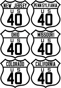
Here is a year-by-year listing of all of the major Route 40 alignments. In many places, U.S. Route 40 has had many alignments through and around major cities such as Baltimore, Indianapolis, St. Louis and Kansas City. If you spot an error or omission, please contact me.
1925/26
U. S. Route 40 established as a transcontinental highway between State Road, Delaware, and Oakland, California. State Road terminus was at the junction of U.S. Route 13; the Oakland terminus was at City Hall.
A 'split' route existed in Kansas and Colorado at the creation of U.S. Route Route 40. U.S. Route 40N ran from Manhattan, Kansas and Limon, Colorado, by way of Clay Center, Beloit, Osborne, Stockton, Hill City, Hoxie, Colby, Goodland and Burlington. U.S. Route 40N was eventually decommissioned and made U.S. Route 24.
The second part of the 'Split Route' was U.S. Route 40S which ran from Manhattan, Kansas to Grand Junction, Colorado, by way of Junction City, Abilene, Salina, Ellsworth, Russell, Hays, WaKeeney, Oakley, Sharon Springs, Cheyenne Wells, Hugo, Colorado Springs, Hartsel, Buena Vista, Leadville, Eagle and Glenwood Springs.
This is speculation, but there was probably some intent for U.S. Route 40S to rejoin U.S. Route 40 at Soldier Summit, Utah. When Route 40 was realigned west of Duchesne, those plans probably abandoned.
Between Duchesne and Salt Lake City, the original alignment of U.S. Route 40 bears no resemblance to what followed a year later. The 1925/26 plan called for the Route to proceed southwest on Strawberry River Road and Timber Canyon Road to Soldier Summit, thence to Thistle, Springville, Provo, Orem and finally Salt Lake City.
U.S. Route 40 follows the Goodyear Road southwest of Fairfield, California, crossing the Sacramento River at Benicia.
1927
The eastern terminus changed to Atlantic City (the intersection of Albany, Atlantic and Pacific Avenues). In the process, the Route through Delaware shifted slightly as the highway was extended into Wilmington for ferry service across the Delaware River. The western terminus also changed to Oakland (Jack London Square).
Between Duchesne and Salt Lake City, Utah, the 1925/26 alignment is decommissioned; the present day alignment through Heber City and Park City is commissioned.
Carquinez Bridge spanning the Sacramento River opens; Route 40 realigned through Vallejo.
1929
Wilmington, Delaware bypassed by the new ferry service between New Castle, Delaware, and Pennsville, New Jersey.
1936
The San Francisco Bay Bridge opens and the western terminus returns to San Francisco (Harrison & 10th).
The 'split' highways in Kansas and Colorado are decommissioned.
1948
New alignment opens between Frederick and Hagerstown, Maryland; old alignment is designated Alternate Route 40.
1950
Alignment through Park City decommissioned and becomes Alternate Route 40 and eventually SR 224. The new alignment parallels Silver Creek to the east of Park City.
1951
The Delaware Memorial Bridge opens replacing the ferry service across the Delaware River. The alignments on both side of the bridge shift slightly.
Alignment between Topeka and Junction City, Kansas shifts south of the Kansas River.
1955
Alternate Route 40 designated as a bypass around the often snow-clogged Donner Pass. The route starts at Reno and goes through Chilcoot, Beckwourth, Blairsden, Sloat, Quincy, Keddie, Storrie, Oroville, Yuba City, Knights Landing and reunites with Route 40 at Davis.
1956
On November 14, the first segment of the new Interstate Highway system opened between Topeka and Junction City, Kansas. Route 40 was realigned to this new section.
1964
U.S. Route 40 is decommissioned in California on July 1. Alternate Route 40 between Reno and Davis also decommissioned.
1966
Western terminus of U.S. Route 40 moved to Reno, Nevada.
1975
U.S. Route 40 is decommissioned in Nevada and west of Silver Creek Junction, Utah.
Route 40 realigned around newly constructed Starvation Reservoir west of Duchesne, Utah.
1983
The last bypass around Lovelock, Nevada completed. The last of the through sections of former Route 40 in Nevada disappears.
Circa 1985
The last official U.S. Route 40 sign (in Reno) comes down. Apparently a highway crew had overlooked the sign for many years.
August 22, 1986
The last section of I-80 is completed between Redwood Road and 5600 West in Salt Lake City, Utah, making it the first completed transcontinental Interstate Highway.
1990's
Alignment rerouted around newly constructed Jordanelle Reservoir, north of Heber City, Utah.
1998
California Assembly Concurrent Resolution 180 designates the portions of US 40 that are still publicly maintained and not already designated as part of Historic US 40 as 'Historic US 40.'
1999
Approximately two miles west of Kansas City are destroyed when the Kansas Speedway is built on top of Route 40. In 2001, the alignment is rerouted around the racetrack.
Here are links to Route 40 highway alignments.


