Alternate Route 40 (Nevada)
NVFor through traffic, extreme weather conditions on Route 40 in the Sierra Nevada Mountains proved to be a constant challenge during the winter months. As the postcard scene on the right shows, snowstorms would periodically shut down Donner Pass. To get a good sense of the impact on snow at Donner Pass, read George Stewart's Storm. If you are a viewer of the Weather Channel, you probably know that the Donner/Truckee area of Route 40/I-80 are frequent subjects of snow reports. Snowfall of ten to twenty feet are not uncommon.
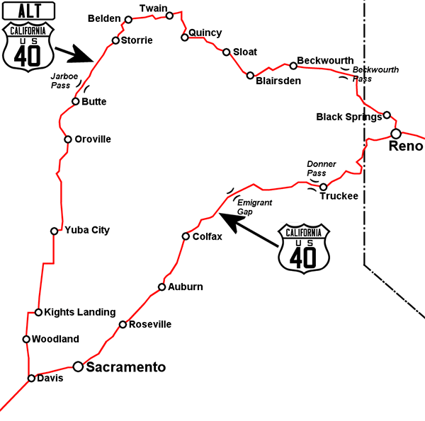
Before the construction of I-80 in the 1960's, another route across the mountains was needed to provide travelers with long distance options. In 1955, Alternate Route 40 was established between Davis, California and Reno, Nevada. Alternate Route 40 was about 95 miles longer than Route 40. Alternate Route 40 was descommissioned on July 1, 1966.
View user comments below.
|
 |
 |
Alternate Route 40 in Nevada and California
|
No comments have been posted.
Feedback: Do you have corrections or contributions for this page? Want to make a suggestion? Click here to send me an e-mail. I am espcially interested in memories, stories, postcards and photographs. Thanks!

Last updated: 2010-10-22 20:09:29 |